Living in the Bay Area inspires one to enjoy nature. This past weekend, I decided to cross the imposing Sierra Nevadas to visit Pyramid Lake, one of the world's most beautiful desert lakes in neighboring Nevada.
 While google mapping directions to Pyramid Lake, I also found Wikipedia's page a good start to understanding the area. Pyramid Lake (approx. 188 square miles) is the largest remnant of Lahontan Lake, an ancient ice-ages lake covering almost all of modern day Nevada (approx. 8450 square miles). The lake is on the Paiute Indian Reservation and is fed by the Truckee River which brings water and silt from Lake Tahoe in the close-by Sierra Nevada mountains.
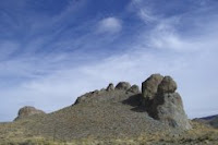
It took 5 hours to get to Pyramid Lake with a brief halt in Reno. The lake is about 30 minutes from Reno. We decided to take local route 445N (also known as Pyramid Way) through Sparks. The scenery was awesome - the mountains with varied textures of yellows, browns and greens with the bright blue sky above were sheer enjoyment. The weather was perfect with a mild breeze and temperatures hovering around the 70s.
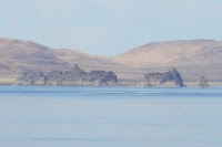
 On entering the reservation, Pyramid Lake emerges on the right. It's a huge, blue mass of water shimmering right next to the 8000' Pah Rah mountains. The Pyramid is strikingly visible, emerging from the lake along with Anaho Island next to it. Anaho Island is home to endangered white pelicans and is off-limits to preserve their habitat.
The primary road for driving alongside the water is on the western shore of the lake through Sutcliffe. The paved road ends a little beyond Warrior Point. The Virginia mountains on the west run next to Pyramid Lake with the scenic route between the hills and the water.
Phenomenal calcium carbonate deposits called "Tufas" form sculptures of nature around and in the lake. Tufas can be seen on the west side of the lake at Pelican Point, Warrior Point, Blanc Tetons, Indian Head Rock, and Popcorn Rocks. Needles Rock on the north end of the lake has a cluster of fascinating thinolite rock forms that jut out of the lake. This area is now off-limits to visitors due to recent vandalism.
 The eastern shore of Pyramid Lake is harder to access. There is only a dirt road (more suitable for trucks than cars). Here there are famous tufas including the Stone Mother Rock, George Washington Rock, Dog Head Rock.
The Paiute Indians run fish hatcheries on the reservation to restock the endangered Cui-ui and Lahontan Cutthroat Trout. Fishing season at Pyramid Lake is from October 1 through June 30 and requires a daily use permit. Camping and boating are allowed year round. The reservation has three towns - Sutcliffe, Nixon and Wadsworth with a ranger station at Sutcliffe. Nixon is the capital and has a high school, health center and  visitor center. A gas station and mini-grocery store called "the Nixon Store" is at the junction of 446 (Sutcliffe Hwy) and 447 (N & S). Hwy 447 S is the route back to Reno. It exits the reservation after Wadsworth. The Truckee River feeds Pyramid Lake from the south and its shallow canyon can be seen running along I-80 W.
The colors and textures of the landscape and the hues of the setting sun accompanied us as we headed back to Reno.


No comments:
Post a Comment